19 July 2021
The Turkestan region is famous for its cultural and spiritual attractions. At the same time, travelers pay more attention to Turkestan. But there are other, no less interesting places in this region. Why tourists should go to the Suzak district of the Turkestan region – we will tell you in this article.
The Suzak district is located in the northern part of the Turkestan region and is considered the largest region in the region. It borders with the Karaganda, Kyzylorda and Zhambyl regions. The local nature will surprise travelers with its beauty.
The Karatau Mountain Ranges are a unique composition of hills that are platforms for viewing majestic panoramas. Here, almost every gorge has a small river, stream or waterfall with crystal clear water that you can drink.
Interesting fact
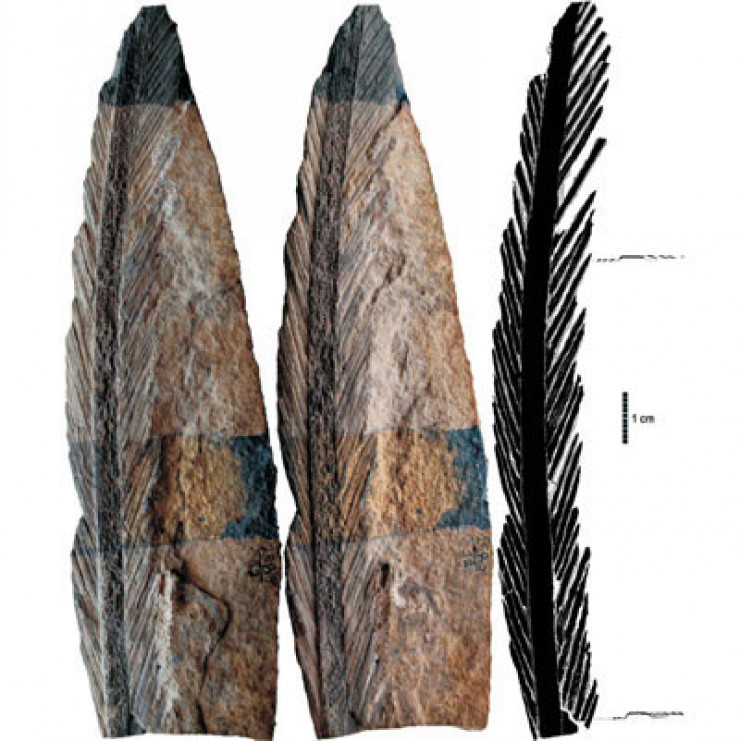
The Karatau Nature Reserve, which covers the central part of the Karatau Ridge, is notable for the fact that millions of years ago there was a large lake on its territory. Here you can also find the remains of reptiles, amphibians and plants that once lived in the reservoir. One of the most famous finds is the wing membrane covered with hairs of a flying reptile – a pterosaur of the Jurassic period and turtle fossils included in all textbooks on vertebrate paleontology.
On the Tripadvisor travel platform, tourists share enthusiastic reviews about visiting the Karatau Mountains.
“Everything is fine, I liked the inspiring places and a lot of interesting stories that I have not heard about this place!”.
“Very beautiful nature to visit and surprises with its unusual beauty, especially in spring. Come here!”.
Here, in the Suzak district, the city of Suzak is located, which is considered the first capital of the Kazakh Khanate, the headquarters of Kerei and Zhanibek. As local historian Bolat Iskakov shared, according to legend, both khans were buried in these places.
“Suzak was a place where the paths of nomadic pastoralists and artisans, farmers who lived on the other side of Karatau converged. Throughout its history, Suzak has been repeatedly attacked by enemies. Located at the intersection of roads leading from the north of Karatau to Turkestan, Otyrar and further to the cities of Aral, Talas and Shu, Suzak, this city was undoubtedly an important economic center of the khanate and was of strategic interest to the invaders,” says the local historian.
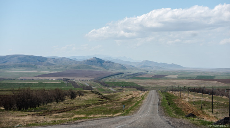
Фото Турар Казангапов
Archaeologists excavated here in 1946 and 1982, they found the remains of a city gate, a bridge support, tandyrs, grain storage vessels, several residential quarters with spacious houses, farm buildings and mosques on the site of the settlement. Minted coins, jugs, bowls, bowls, lamps were found in them. According to experts, this land is a real storehouse of historical breakthroughs. However, no serious research has been conducted in these parts.
Guide Islam Kalani says that tourists are offered several different routes in the Suzak district.
“A visit to the ancient settlement of Suzak – the first capital of the Kazakh Khanate-includes a tour of the spring that gave rise to the medieval city and the river, ancient mazars and mosques. A trip through the streets of Suzak. Picnic on the bank of a spring river. The cost of the trip for a company of four or five people is 30,000 tenge.
There is a tour “Shymkent – the village of Aksumbe in the Suzak district”. The distance is 320 kilometers. We suggest visiting the watchtower of Aksumbe of the XIII century, built during the time of the Khorezmshahs. Here you can relax on the shore of the reservoir. The cost of a trip for a similar company is 40 000 tenge.
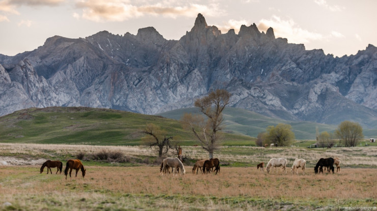
Фото Турар Казангапов
The tour “Shymkent – the natural basin of the Koshkarata River with two waterfalls in the Karatau mountains” involves overcoming a distance of 120 kilometers. Tourists walk along the mountain gorge, swim and have picnics. The cost of the trip is five thousand tenge per person or 25,000 tenge for a car with an excursion for four people.
The tour “Shymkent-Baba-Ata village in the Suzak district and lake Kyzylkol”. The distance is 170 kilometers. It includes a visit to the medieval maktab, the mausoleum of Iskhak Baba, the ruins of a feudal castle of the VIII century and a mazar of the XVII century. Then a trip to Lake Kyzylkol, to the Paleolithic sites and the canyon of the Ushbas River. The cost of the trip is 40 000 tenge. The price includes a car and an excursion.
All prices can be negotiated depending on the circumstances. Excursion by car of the customer 18 000 tenge. The tour in English is 30,000 tenge, ” Islam Kalani said.
Kelinshektau mountain range
The Kelinshektau mountain range is another place in the Suzak district that is worth visiting. The height of the main remnant is 1,729 meters above sea level. The eastern spur of the Kelinshektau massif stretches from southeast to northwest for 10 kilometers, the western ridge stretches from south to north for eight kilometers.
Tourist Nazerke Makhanova, telling about her journey to the foot of Kelinshektau, says that it is not difficult to get to these places. But it is better to take a guide who will show the best points to admire nature, and the best trails for walking around the neighborhood.
“Kelinshektau will rise right before your eyes like a castle. And at the foot you will see a village surrounded by green spaces, called Abay. In this village you will not find any cafes or restaurants. Tourists visiting Mount Kelinshektau can eat in the village of Sholakkorgan, which is located 37 kilometers from the village of Abai. Here you will find different types of cafes and try traditional Kazakh dishes, ” she says.
The name Kelinshektau comes from the Kazakh word “kelinshek”, which means “bride”. And the Kazakh word ” tau “is”mountain”. One of the legends about the mountain explains why this mountain range is named after the bride. Not far from these places, a girl Aisulu lived in a village. Her father loved her very much and spoiled her all her life. When it was time to get married, my father arranged a magnificent holiday and collected the best dowry – all the items were gold. However, Aisulu found something among the dowry that upset her very much – a dog bowl made of silver. She demanded that her father change the bowl for a gold one. The disappointed father cursed her for her ingratitude and wished her to turn into gold herself. After that, Aisulu and her caravan with the dowry turned into stone, forming a large mountain range of Kelinshektau.
Interesting fact
Among other legends about the mountain, there is one that tells that dragons lived in these places, and the mountain itself is a large petrified dragon. And the” proof ” is a rock painting at the foot of the mountains, illustrating reptiles with large wings. Some believe that the dragons, which fly only at night and hide very well, still live in the mountains of Kelinshektau.
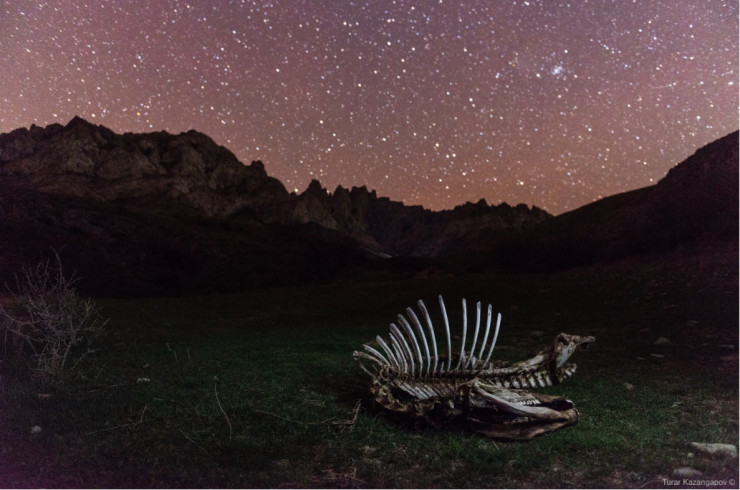
Фото Турар Казангапов
In 2017, in the Suzak district, at the foot of Kelinshektau, in the village of Abai, local residents found two stone sculptures dating from the XII century. The monuments are located along the Arpa River. The stones, which were facing east, depict women and men. The exhibits are stored in the district museum named after S. Kozhanov.
Karatau petroglyphs
Karatau petroglyphs are images carved on the rocks of the gorges of Karatau in the Bronze Age and the Early Iron Age. They were found in large numbers in the tracts of Koibagar, Arpaozen, Maidamtal, Ulkentura, Kysan, Zhyngylshak, Koshkarata, Suyundiksay, in the Aksu-Zhabagly nature reserve. A total of 3,045 compositions and individual images were found. There are 2,765 of them in the Arpaozen tract alone.
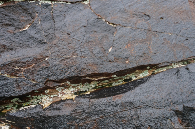
Фото Турар Казангапов
Karatau petroglyphs are mostly carved on rocks and boulders of various sizes. They reflect the economic life of nomadic tribes of the corresponding era, as well as their religious beliefs, customs, traditions, rituals. There are images of birds, animals, animals. The subject matter of the images is diverse, carries a certain semantic load. For example, the image of a camel symbolizes wealth and strength. Many rocks are carved with scenes of hunting a mountain goat with dogs, catching birds. There are images of warriors with spears and clubs in their hands.
Guide Islam Kalani said that travelers are offered a trip to the picturesque gorge of the Karatau mountains and a review of the ancient gallery of petroglyphs dating back five thousand years at the foot of the Kamennaya Bride Mountain (Kelinshektau). The tour also includes a visit to the ancient city of Sauran.
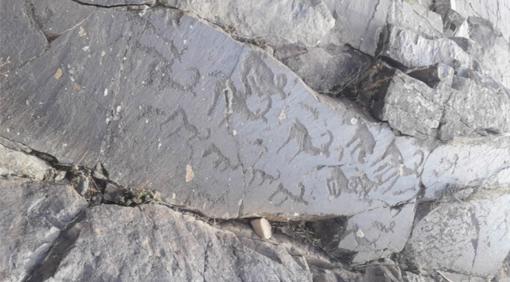
Фото с сайта silktrip.kz
Kyzylkol
Lake Kyzylkol is called the “pearl” of the Suzak district. It is located at the intersection of the steppe and mountains. It is said that the salt water and the healing mud of the lake cure joint diseases and other diseases.
There used to be many recreation centers and sanatoriums on the bank of Kyzylkol, where people often rested and were charged with the energy of the steppe, mountains and fresh water. But in the 2000s, the reservoir began to slowly die. This is partly due to human activity, partly due to natural causes. Scientists are arguing about this. Recreation centers began to close, the demand among tourists fell.
According to local stories, the lake has begun to come to life over the past few years: birds have returned, the banks have turned green, carp fry have been launched. Kyzylkol is most popular among Shymkent residents and tourists from Zhambyl region.
Lake Kyzylkol is located five kilometers southwest of the village of Kumkent and is the westernmost in the system of lakes of the northern foothills of Karatau. And in the vicinity of the lake, among small pebbles, there are the remains, the teeth of ancient sharks that lived here millions of years ago.
How to get
The district center of the Suzak district is the village of Sholakkorgan, 180 kilometers from Shymkent. For movement, it is better to choose an SUV.
To get to the petroglyphs near the Arpa River, you need to drive from Turkestan to Sholakorgan. A bus runs along this route. From Sholakorgan to the village of Abay, you can take a taxi. Then it will be necessary to overcome six to seven kilometers on a dirt road. You can pass them yourself, but it will be difficult for you to find a place yourself, so it is better to immediately ask someone from the locals to bring you, they know this road well and will willingly agree to the offer for a fee. Along the way, you will see views of the peaks of Kelinshektau. You need to get to this mountain by a dirt road, in the opposite direction from the Arpa River.
It is closer to get to Lake Kyzylkol from Sholakorgan. And from Shymkent on the highway to Sholakkorgan to the lake – more than 200 kilometers. Before reaching 15 kilometers to Sholakorgan, you will need to turn east, to the right. The entire road is paved. And after the turn, you need to drive another 25 kilometers along it. At the “Kyzylkol” sign, turn onto a dirt road and drive another three or four kilometers to the beach.
Информация взята с сайта Tengritravel.kz


